
In the Friday Foto, I introduced you to a distant shot of one of the satellite dishes of the VLA (Very Large Array). See here for information. The VLA is an interferometer; it operates by multiplying the data from each pair of telescopes together to form interference patterns. The structure of those interference patterns, and how they change with time as the earth rotates, reflect the structure of radio sources on the sky: we can take these patterns and use a mathematical technique called the Fourier transform to make maps. The 27 antennae were set up in the 70s at a cost of about $1 per taxpayer ($78,578,000 in 1972) and formal dedication took place in 1980. The VLA is used primarily by astronomers and for atmospheric/weather studies and other sciences.

When we drove down to Pie Town for my mother's birthday, we drove past the VLA and on the way back home we stopped for a visit.


To the left is the hanger where they work on the VLAs. Each antenna weighs 230 tons and stands 82 feet tall.


This photo shows the size of the VLA. Did you notice my son and daughter standing in the gateway?


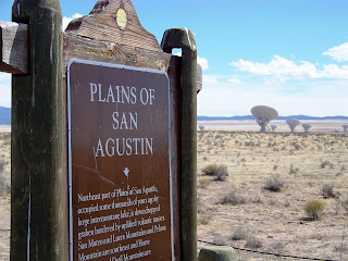
The 27 radio antennae are arranged in a Y-shaped configuration on the plains of San Agustin.

The antennae are arranged in four configurations, or arrays. There is an A array, B array, C array, and D array, varying in antenna separation of 1km to 36 km apart. At it's highest frequency of 43 GHz, a golf ball, with a high-power radio transmitter inside, can be seen 100 miles away.

Is there anybody out there?
Transition Transmission- song: TVC15, artist: David Bowie, album: StationtoStation

 The Very Large Array, one of the world's premier astronomical radio observatories, consists of 27 radio antennas in a Y-shaped configuration on the Plains of San Agustin fifty miles west of Socorro, New Mexico. Each antenna is 25 meters (82 feet) in diameter. The data from the antennas is combined electronically to give the resolution of an antenna 36km (22 miles) across, with the sensitivity of a dish 130 meters (422 feet) in diameter. For more information, see
  Here's Lisa and I standing near one that was being worked on in a hangar. I wonder what they need to do to fix them?
 An interesting fact about


 I'm not sure what happened with the lighting in this picture but doesn't it look kind of "alien abduction" or something?
  Here's Lisa's Bionic leg.
 Thirty-six miles west of Magdalena, at the western edge of the San Agustin Plains, the Datil Mountains rise and pinon and juniper trees emerge from the bush and grass. At the intersection of U.S. 60 and S.R. 12 at an elevation of 7500 feet sits the town of Datil.


 Twenty-one miles further west on U.S. 60 at the lower altitude of 6970 feet lies Quemado, named for the Spanish word for "burned." When Jose Antonio Padilla settled by a creek east of the present town in 1880, he found that the surounding brush had been burned by the Indians, so he named it Rito Quemado.


